


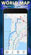
Offline World Map

Offline World Map का विवरण
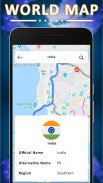
Offline World Map Atlas 2018 is made with almost 250+ country information like Country Flag,
Currency, International Telephone Code, Location in the Map, Languages Spoken, Economy, Borders, Continent.
Offline World Map Atlas 2018 Also known as:
Offline World Atlas 2018 - World Map Atlas 2018.
Offline World Atlas & World Map 2018.
Offline World Atlas - Continent, Country, Capital.
Offline World Atlas Countries Maps 2018.
Offline World Map Offline - Political.
Offline World Map Offline – Physical.
Offline world Atlas Android.
Best Offline world map app.
Best Offline world map for android.
Best Offline world map app for android.
Offline World Map GPS.
Offline World Map.
Real live google earth satellite street view.
Live satellite street view real time.
Satellite street view.
Live maps satellite street view.
GPS route navigator local map gives Traffic live update.
GPS route maps with HD street view.
GPS maps with live navigation and traffic alerts.
Open street map live view Traffic Status and Updated Map quest.
Offline World Map Atlas 2018 to quickly find countries and cites like India,Canada, United Kingdom, Australia, Sydney, Melbourne, Japan, Tokyo, China, Shanghai, USA, Brazil, Sao Paulo, Brasilia, California, New York, Europe and More!
Features of Offline World Map Atlas 2018:-
- Street-view Map Offline World Map Atlas 2018
- Satellite Map Offline World Map Atlas 2018
- Normal Map Offline World Map Atlas 2018
- Hybrid Map Offline World Map Atlas 2018
- Live Street View Maps Offline World Map Atlas 2018
- Live Satellite Map HD Offline World Map Atlas 2018
- Navigation maps with GPS for city, traffic and public transport routes
- Easily track all places you visited through GPS route tracking
- Route planner for cars, bikes and walking to any global address
-Show All Live GPS Information
- Learn all the countries flags and countries capitals of the world.
- Full screen images for all countries' flags.
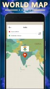
- Countries' geographical location via Google Maps.
- Turn by turn navigation and route update.
- Show distance and travel time during route.
- Auto Detect the current location.
- 2D, 3D and satellite Map.
- Up to date maps.
- Search the any nearest point.
- See Live Satellite Map Views.
- Find a country easily with a convenient globe map
- Educational reference map for students, school, and university
- Map revolves around compass
- Street View Traveler - Go around in the street – HD
- Get direction; by Foot, Bus or Car.
- Distance to the Target Address
- The Shortest Route on Map
- All Information About Countries
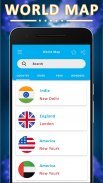
- Search country
- Navigate to country in the map from search
- View the country flag, capital city and international phone code
- Zoom In/Out with the seek bar
- Zoom In/Out with tow fingers
- Share and rate
You can also learn about:-
- Top 10 Rivers
- Top 10 Mountains
- Top 10 Wonders
- Top 10 Peak
- Countries Fact
List top 10 in the world about:
Rainest places
Longest rivers
Largest area countries
Lichest countries
Smallest area countries
Least populated countries
Largest beaches
Largest deserts
Hottest countries
Wonders
Demographics
•Life expectancy
•Median age
•Birth rage
•Death rate
•Sex ration
•Literacy
Transportation
•Waterways
•Roadways
•Railways
•Airports
Economics:
•Gross domestic product [GDP]


